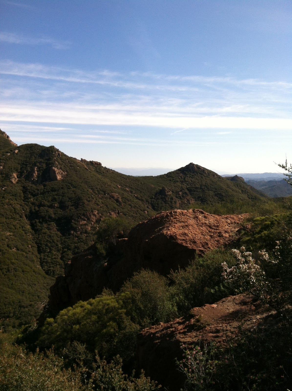
I have been trying to see a little bit of California every weekend, and this weekend was no exception. I had made plans with my friend Molly, who lives in LA, and some of the folks I work with to hike up Sandstone Peak, the tallest peak in the Santa Monica Mountains. We had a 6-mile loop planned to Sandstone, with a 3.5 mile hike to the Grotto if we were still feeling frisky after the first hike. We woke up on Saturday morning to 65 degrees and sunny. Couldn't ask for better weather. By the time we reached the trailhead, it was already 70 degrees. We met Molly around 9 am and began the gradual loop that would wind us along the Mishe Mokwa Trail, passed Echo Cliffs, and with a nice view of Balanced Rock. There were plenty of opportunities for photo ops, the scenery just kept getting better.

The trail contoured along Boney Mountain on the western edge of Carlisle Canyon and then dipped down to Split Rock. After Split Rock, we began to climb up again and found ourselves at Inspiration Point. We had great views of the ocean from here, including Catalina Island and two of the Channel Islands. To the left is a pic of my crew enjoying the view out to the ocean. From Inspiration Point, we had a short steep section up to Sandstone Peak. Sandstone Peak, or Mt. Allen (as it was labeled in honor of the Mr. Allen that originally donated this land to the boy scouts) sits at 3,111 feet and offers views in all directions. We could see the house that we can see from our camp that used to belong to the famous Jack Nicklaus. Pretty cool. We could also see snow-capped Mt. Baldy, which is on the PCT, and I want to hike up badly!

After enjoying some lunch at the top, we made our way back down to trailhead number 1. Molly decided to skip out on the second hike because she had homework (lame!) but the rest of us decided to go for it. The Grotto hike trailhead was right down the road from Sandstone Peak. After parking, we began the downhill hike, crossing over Arroyo Sequit, down to the canyon floor. We passed a grassy ridge that made me pine for the grassy balds of the Appalachian Mountains. Almost to the canyon floor, we saw this big jumble of rocks that led the way to the cool water of the Grotto (think Mahoosuc Notch for all you AT hikers out there). We climbed and scrambled down and were rewarded with nature's playground of rocks and hiding spots, quite different from our first hike.
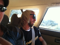
After watching some guy almost fall into the water, we began the climb back up out of the canyon. I was happy that I had correctly figured out where the Grotto was from Sandstone Peak. For those of you that hike with me on a regular basis, you know I am often "slightly off" my calculations. Maybe this is a sign of improvement. Being that it was 80 degrees out and we had put in almost 10 miles of hiking, the obvious next plan was frozen yogurt. A very curvy/windy 13 miles later, we had our fro yo and the end of our hiking excursion. Matt had so much fun, he couldn't keep his eyes open on the return trip!

 After enjoying some lunch at the top, we made our way back down to trailhead number 1. Molly decided to skip out on the second hike because she had homework (lame!) but the rest of us decided to go for it. The Grotto hike trailhead was right down the road from Sandstone Peak. After parking, we began the downhill hike, crossing over Arroyo Sequit, down to the canyon floor. We passed a grassy ridge that made me pine for the grassy balds of the Appalachian Mountains. Almost to the canyon floor, we saw this big jumble of rocks that led the way to the cool water of the Grotto (think Mahoosuc Notch for all you AT hikers out there). We climbed and scrambled down and were rewarded with nature's playground of rocks and hiding spots, quite different from our first hike.

No comments:
Post a Comment