Friday, April 26, 2013

Smoky Mountain Relay

For the past several months, I have been training for the Smoky Mountain Relay. It's a 212-mile relay ran by 6 or 12 team members. I was on a team of 12, and we definitely were the best team there, at least in team spirit. Our official team name was Hiker Trash on the Run (HTOTR) because most of the runners are long-distance hikers who have some pretty awesome hiking accomplishments under their belts. Our unofficial team name/mascot was Zebrasaurus. This comes from the combination of several team members living in the Zebra Hill house in Asheville and from team captain Dinosaur/Kathryn/K$. Izaac, our team costume designer, created the mythical Zebrasaurus and put it into costume form. You can see what Zebrasaurus looks like from this group shot from the start of the race.

HTOTR met early Friday morning at Dino's house to get the party started. A few of us had met the night before for a pre-race dinner, but the Raleigh & DC contingents didn't get in until late. After a round of sleepy introductions, we loaded into our two rented 15-passenger vans and headed for the start of the race near Brevard, NC. The forecast for the day was 80% chance of rain and t-storms. For once, the weather folks were spot on. Pockets of downpour made for an interesting day of running and relay exchanges. We made the best of the weather by drinking lots of hot green tea mate and by Zebrasaurus making an appearance at every exchange.

After my van passed off the relay wristband to the second van, we had a several hour break to rest up for the night section of the race. We hit the grocery store and then napped away the afternoon. Luckily, the weather started clearing up as it got closer to our next section of race. While we were waiting for our other team van, we met another really funny team called the Pusseyfooters. Their van had a life-size cheetah hanging out on top and cheetah print covering their rental van. Very classy. Around dinner time, we heard from our other team van that they were really close. We got ready for the next exchange, and we were off!

The next few legs were some of the longest for my team's runners, but also some of the fastest. Kerby had to do a 9.8 mile leg, but averaged something around 7 minute miles. Between his run and Izaac's crazy fast 5-mile leg, we had passed quite a few teams. By the time my turn came around, I didn't really have to worry much about getting passed. So I took off just after dark and enjoyed my 5.4 mile leg through the rolling hills not too far from the big town of Otto, NC. Two more runners later, we had an 11 pm exchange with van 2. All of us were pretty pooped and ready for some much needed shut-eye.

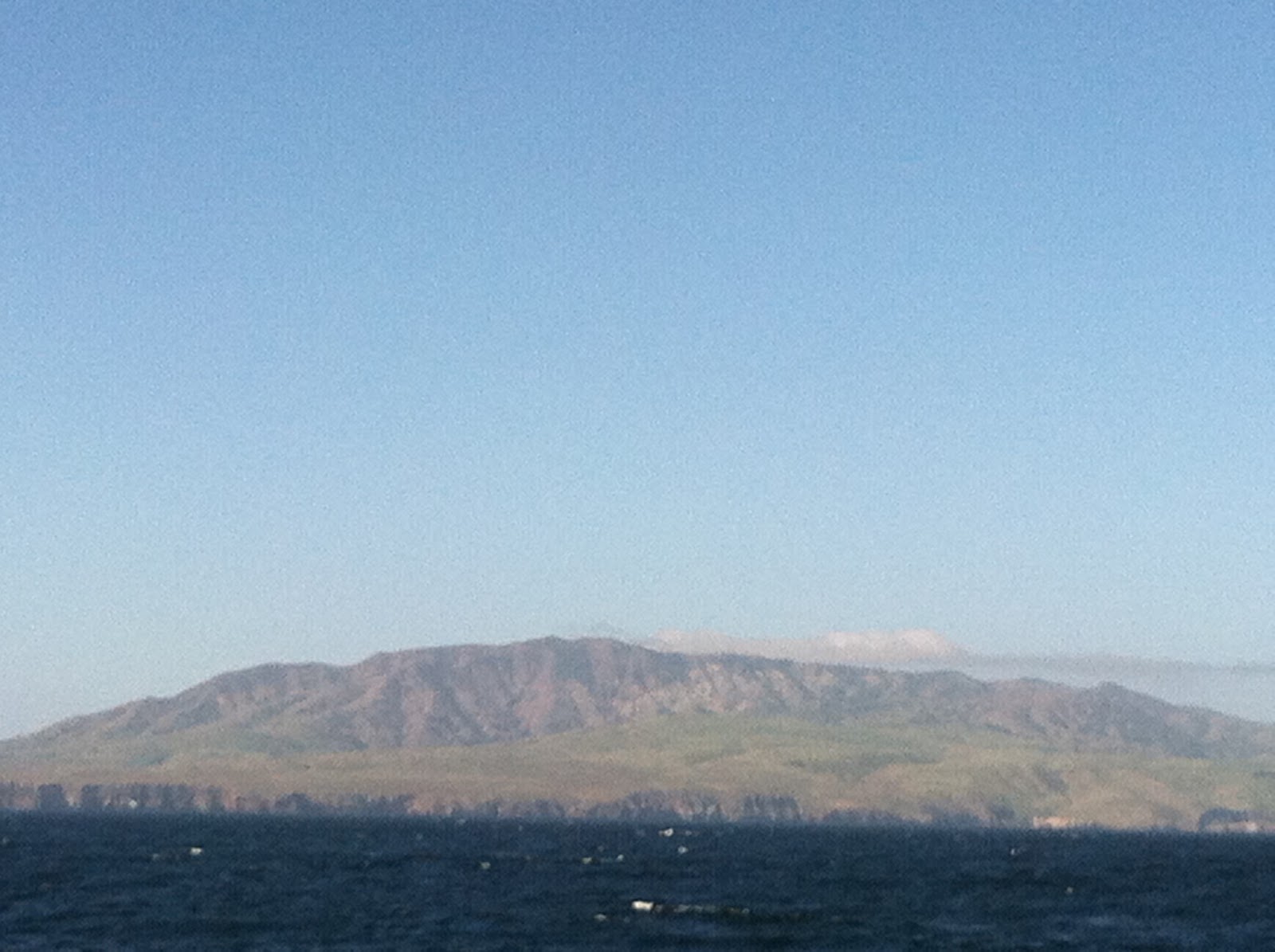
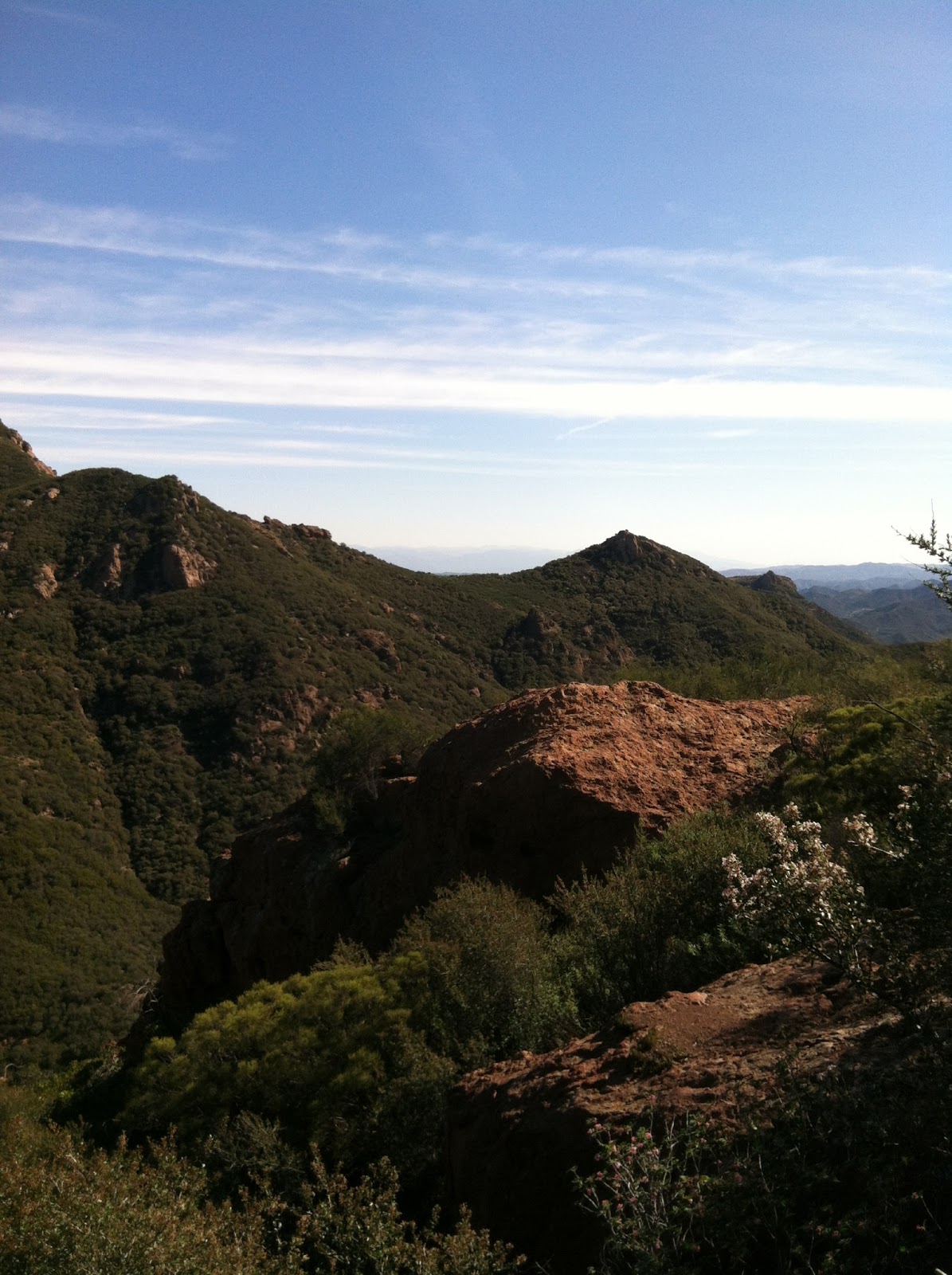
After figuring out how to get to the next exchange, via some really long forest service roads, we set-up camp around 1 in the morning in just above freezing temps. 4 am came WAY too early. Van 2 had made up even more time overnight and we were one of the first three teams on the course. We begrudgingly got out of our warm sleeping bags and took down our tents. Kayah was up first and she ran like a champ despite not having any green tea mate power in her veins. Kerby and Izaac ran so fast they beat the sun, so I was the lucky runner who got to see the sun come up on my leg. It was especially great because I saw the sun just as I was cresting Tellico Gap and the Appalachian Trail crossing. The climb up to Tellico was a bitch, but I was able to make up some time by running downhill for the next 4.5 miles. My quads were burning, but I had the best time singing my heart out to some country music as the sun was rising. It certainly was a great morning to be alive and to be healthy enough to be running this crazy race.
Check out this video of my finishing up my final leg. Notice the snazzy vest. Several of us tried to look our best for various legs of the race.
Tori and Mark brought it home for Van 1. We made our final exchange with Van 2 and headed out for some much needed breakfast. Luckily, one of the local fire departments offered an all you can eat breakfast for $5. After chowing down and catching up with one of the teams we were neck and neck with (Dead Goats Society), we headed for the NOC. We hooped and hollered for the teams we passed en route and then collapsed in the ice cold water of the Nantahala River upon arrival. Rather, Kerby, Izaac, and Tori collapsed in the water while the smarter team members (Kayah and myself) collapsed on the picnic table.

We had a decent wait for our team, since they still had some 50 miles still to run. We spent the afternoon napping, snacking, and playing games. Finally, the other van arrived. So far, no other teams had crossed the finish line. We all headed to the end of the course and waited patiently for our last teammate and captain - K$/Dinosaur/Kathryn to come flying down the trail. And fly down the trail she did! She didn't bother to stop and wait for us. Which way to the finish? We all took off behind her and crossed the finish line. Since the race officials wanted us all to finish together, we did a slow motion crossing of the finish line. Pretty hilarious.

We were the first team to cross the finish line - hooray! That meant we were the winner, right? Not exactly, but we milked it for all it was worth. We had the satisfaction of watching all the other teams finish, while we chowed down on BBQ and beer. It was nice to chat with some of the folks in van 2 since I didn't know them well. They had some pretty elite runners also. They had Moe, who ran the "Tough Mother" section and sailed past the team that was beating us. They also had Mark, who had ran the Boston marathon just last week. I feel fortunate to have been on such a kick ass team.

As most of my teammates headed back to where they came from, a few of us stayed around to watch the other teams finish and enjoy the beautiful spring day. A spontaneous dance party erupted, and several race officials joined in. The moment we had all been waiting for was seeing Seth Avett (one of the famous Avett Brothers - a favorite music group of mine) cross the finish line. I was off playing soccer with a few teammates and thankfully Dino came and pulled me over. That's the closest I have ever come to meeting him. He looked just like the rest of us, tired and satisfied after two days of running. Super stoked to see him either way.

I'll leave you with this funny shot of the best dressed group of runners at the race - Izaac, Tori, and myself. What a great experience. Can't wait to do something this crazy again. Oh yeah, and did I mention we actually came in 3rd out of 23 teams? Not too bad for this hodge podge group of runners who weren't even sure we would finish.


Sunday, April 7, 2013

Santa Cruz Island Adventures

For my last full weekend in California, I decided to head to the Channel Islands, Santa Cruz Island to be specific. I was torn between exploring the Channel Islands or Catalina Island. There is diverse flora and fauna on both, but decided I would go to the more remote, undeveloped Channel Islands. I chose Santa Cruz Island because it's the biggest island off the coast of California and had the most trails to chose from. At first, there was a group of work people going to join me, but being it was the last weekend here and the steep $80 boat ride over there, it turned out being just me. We all know I don't mind camping by myself. In all actuality, I was looking forward to the peace and quite of being by myself and enjoying the last bit of my time here in southern California.

The ride over to the island was a bit choppy, but we did spot a teenage whale (cool!). We weren't just traveling with human passengers, we also had five baby sea lions that were being rehabilitated somewhere near Ventura. They were being carried in dog crates and we were supposed to drop them back into the ocean near Smugglers Cove. A few of them jumped right in, but two of them, were hanging of for dear life. They did not want to go back into the wild. It was so cute to see those guys, and way cool to see them being reintroduced into their natural environment.

After dropping off the sea lions, we finally made it to Prisoners Harbor, my home for the night. I quickly carried my stuff to the campsite, set up camp, and what did I see? An island fox, found only on the Channel Islands. It was sniffing around a few campsites. They area about a third smaller than your average fox and ten times cuter. They were almost extinct a twenty years ago when the golden eagle hunted them to extinction. The park was able to relocate the golden eagles and gradually bring back this cute little guy.


Finally all set up, I took off towards Smugglers Cove, my trail run destination. A few of you know I have been training for the Smoky Mountain Relay, coming up in less than two weeks in Asheville, NC. Instead of hiking on the island, I knew I needed to complete at least one long trail run. The scenery and trail condition didn't disappoint. The climb up out of Prisoners was pretty brutal, but not as much as the descent and ascent into/out of Smugglers Cove. Definitely burnt some calories there. The scenery was well worth the strain. A few day hikers looked at me like I was crazy, but I had the best time seeing the island this way. When you don't have much time to see an entire island, jogging definitely increases the surface area in which you can see.
 

After getting back from my (almost) 8 mile trail run, I downed a quick lunch and tried my hand at snorkeling. The ocean had other ideas. I got the shit beat out of me trying to snorkel with the tide coming in and the gale force winds surrounding the islands. I tried for about an hour, looked like an idiot, and called it quits. Between the trail run, and the the "snorkeling," I was pretty much done for the day. I did try one last hike before calling it quits for the evening - Cavern Point. It was an easy two-miler, but crazy windy. Check out this video to get a feel for how windy it really was. I could barely stand up without being blown over.
Soon after, I retired to the campground for a thru-hiker dinner and some white wine from a box (we all know I'm classy!).

I woke up Sunday morning anxious to get in a hike or two. Because of the wind, the island shuttle service was asking us all to leave around 11:30 am instead of 4 pm. I quickly packed up camp and took off on a 5-miler to Potato Cove. I'm glad I did because it was a really neat area. The water was this crazy teal green/blue. I enjoyed my last bit of scenery before heading back to the boat landing. All in all, a successful trip, and a great last full weekend in California.


Friday, April 5, 2013

Spring Break Part 2 - Kings Canyon & Sequoia National Park

After cleaning up and re-gearing, I picked up Dinosaur from LAX and we were off to the mountains! We made really great time, I was super stoked to miss out on the infamous LA traffic this time of day on a Friday. We chose to go through the Big Stump entrance to the park, so we could explore Grants Grove before heading into the backcountry. The weather was perfect as we climbed in elevation, getting closer to the park. One of those blue sky days that feels like it could go on forever. After scouting out a front country site, we quickly set up camp and headed down the trail to the third largest tree in the world. That's right, the world. All the trees in Kings Canyon/Sequoia were crazy beautiful. You just wanted to hug all of them. We played in tunnels that were really hollowed out old trees that had fallen, read lots of interpretive signs, and just enjoyed staring up at these old giants. General Grant was 1700 years old, which isn't even the oldest tree in the world. They all made me feel really small.

The next morning, we took our time driving through the park. We had to make the obligatory stop at a visitor center to watch a movie about the park and learn about the history. I was happy to have a companion that also didn't mind learning about things! Then went to see the BIGGEST tree in the world (by volume) - General Sherman. Compared with General Grant and the trees that surrounded it, the trees around General Sherman seemed smaller. It was definitely more noticeable that this tree really was the biggest thing around. Supposedly, it's so big that it would take 21 people holding hands around the tree to cover the circumference. Now, that's big! This portion of tree that  Dino is hugging gives you an idea about how big it is.

We next hit the Foothills Visitor Center to get our permit (safety and park regulations first!) and to find a little more about trail conditions and weather. Thunderstorms and rain were headed our way, but blue skies were still abundant. We ate a nice lunch, while learning about the native people of the area, loaded our packs (complete with bear canister) and hit the trail. We thought heading out on the trail would thin out some of the crowds, but we saw a ton of people on the Middle Fork Trail we were on. There are only so many trails that are not covered with snow here, so I should have known better. We followed the middle fork of the Kaweah River up towards the High Sierra. Our initial destination was Redwood Meadow - supposedly one of the most remote groves of old trees in the park. Everyone we talked to on the trail that got there said it was super neat. But after a late start, and enjoying the beauty of the trail, we decided to call it quits at Mehrten Creek. Good thing we did, because it starting raining on us as soon as we took our packs off.

After a fairly rainy night, and an even rainier morning, our stuff was a bit damp. I had chosen to go with my ultralight shelter, which is not quite decided for two people in the rain. Needless to say, there were a few wet sleeping bags and pads. More rain was on the forecast, and we were on vacation, so we decided to not be hardcore and instead hike back out. We would have had to do a big mile day to get to Redwood Meadow, and we just didn't want to be in a hurry. Of course, as soon as we got on the trail, the weather cleared. We thought about going back up, but decided finding the hot spring I had heard so much about would be a better option. The weather was great on the way out and we stopped quite a bit to take photos and enjoy the view. One spot at Panther Creek was particularly pretty, and we took a long break there. Some folks came down the trail that had made it to the meadow and showed us some pictures. We got to see it after all!

After eating lunch, we began the long drive to the Remington hot springs. They were near the town of Lake Isabella, which isn't too far from Walker Pass and the PCT. Dino remembered visiting Lake Isabella on her PCT thru-hike and kept going on an on about some milkshakes at a diner with an older lady's name. So, we of course had to check it out. Being that we were itchy to get out of the car, we hit the hot springs first. We couldn't find the hot springs right off the bat, but did find two very hippy-looking buses that would definitely know where the hot springs were. Sure enough, they pointed us in the right direction. I wish I could have stayed and chatted with those folks. They looked like they had some stories to tell! The hot springs were amazing!!! We didn't have them to ourselves, as it is a popular area not too far from a road. But these hot spring were definitely well taken care of. Someone had poured concrete in the pools and had constructed several bathing tubs that were nicely decorated with pretty rocks, stones, and writing. Each of the different tubs were a different temperature, but all toasty warm. They felt great after a few days of hiking and even better that it was kind of chilly and misting. We made some new friends and soaked in the springs until the rain started coming down a bit harder. Everyone grabbed their stuff and headed back up to the vehicles.

I had planned on camping at one of the established campgrounds in the area, but decided camping in Buddy the truck just off the road would be just as great. That's what forest service land is for, right? Later that night, there was a car that parked near us for about an hour. Sensing they were not moving, Dino was brave enough to ask if they were lost or needed help. Turns out it was a nice older hippy that looks after the springs from time to time and was camping out as well. Looks like we have a neighbor for the night. Woke up, made some coffee and tea, and decided to eat breakfast in town, complete with famous milkshake. Turns out it was Nelda's diner, and it was delicious. I don't think many people order a milkshake with their breakfast, but I was a satisfied customer.

I had to be back to work the next day, and Dino had a plane to catch, so we headed back toward Malibu. I showed Dino around where I lived/worked, and then took her to some of my favorite beaches. The weather, and the sea life, definitely cooperated. We saw dolphins, sea stars, California mussels, anemones, crabs, amongst other sea creatures. Not to mention a nice sunset. All in all, a great trip, and the perfect end to the first spring break I have had in years.


Wednesday, March 27, 2013

Pacific Crest Trail - Spring Break Part I

The first part of the first spring break I have had in five years was supposed to be a 60-mile section of the Pacific Crest Trail. Good thing life doesn't always happen the way you want it to :). On my way down to southern section of the PCT, I decided to stop in Joshua Tree National Park because I have never been there and need to check it off my CA National Park list. About a mile from the Joshua Tree National Park Visitor Center, a semi-truck kicks up a rock that brazes my windshield, creating a nick that won't soon go away. Not a good omen. Despite the damage to my trusty truck, I stop at the Visitor Center to check out my options for the evening. I naively though I might score a frontcountry campsite where I could have a campfire and drink beer to my hearts content. No dice. Luckily, I am carrying enough gear for several folks to go backpacking. I decide to do a quick trail run before heading to the backcountry for the night.


On my way into the park, I really took my time. I had heard from several friends that I wouldn't like Joshua Tree because it wasn't that pretty. Untrue! The landscape is very different from what I am used to, but alarmingly pretty. After taking the obligatory entrance shot photo, I head to the Boy Scout trailhead where I commence to run a 6-mile out and back that borders the Wonderland, the best place to do anything fun in the park. I thoroughly enjoyed the namesake tree of the park on my run. I returned from my run very thirsty, but thankful for my time in the park.

I decide it is worth it for me to drive to Keys View, supposedly the best view in the park. It was pretty cool to see the San Andreas fault from a distance. I also saw Mt. San Jacinto and Mt. Gorgiono's snow capped peaks from a distance. Some day. Amidst the day hikers, I took some time to stare at the PCT off in the distance. I descend from Keys View to drive through the rest of the park. I really debated whether this was worthwhile or not. I am glad I did. I was able to see the difference between the Mojave and the Colorado desert, including the Cholla Cactus Garden and Skull Rock.

I drove all the way through the park, ending at the Cottonwood Visitor Center. Since all the frontcountry camping sites were taken, I knew I needed to camp in the backcountry. I parked at the Cottonwood Spring trailhead and hiked in a mile to a very nice spot where I could see the sunset and enjoy a cold beer or two that I hiked in. It feels so nice to camp outside again after several months of not camping. I can't stop from smiling.

I wake up outside, in my tent, in anticipation of the PCT hike to come.  I quickly take down my camp and hike back to the Cottownwood Spring trailhead. I am so excited to meet Mick, I go directly there, barely stopping to get gas and get food. I had an amazingly pretty drive through Palm Desert and the town of Warner Springs. I get to the trailhead super early, where I organize my gear and get ready to leave Buddy (my truck) for a few days. Mick and I are at different trailheads, but quickly figure out how to meet each other. We leave my truck at Montezuma Valley Rd and head to Pinney Pines. After checking and re-checking all our gear, we are on our way down the trail.

A few miles in, all is as it should be. Mick and I are catching up on a few years gossip. We both feel great and the scenery is spectacular. I heart California. We pass the spot we had intially thought about camping and decide we should push forward, as we are both feeling good. We end up just north of Sunrise Trailhead in a grassy meadow we are both comfortable camping. The moon looks full and the trail very promising as we make camp. A night of Eygptian rat screw and catching up quickly fades into morning.

On day two, we end up hiking 18 miles, not for reasons initially expected. We both wake up super happy to be on the trail. But Mick's blisters set the pace for the day. Her feet are not happy, so we make accomodations to stay on schedule. Sometime in the afternoon, we realize that happiness is not 100% guaranteed. We decide to hike to Scissors Crossing so we are in good condition to hitch back to my truck the next morning. This proves more difficult in reality. The water source at Rodriguez Trail is not what it should be, and the trail north of that is not as easy as it should be. We get slightly lost, but also get found along the PCT. I encounter a cactus that is not very friendly, but Mick helps keep me sane by pulling out the quills. We both finally make it Scissors Crossing and camp between the two roads.

We wake up to hummingbirds twitting about and the road open to whatever we need. We celebrate the beautiful morning by cooking oatmeal and drinking tea. We soon realize a ride would be most helpful and take down camp. After only 30 minutes of standing with our thumb out, we get a ride from a nice woman whose mare is about to give birth to a calf. It's Mick's first experience with hitch hiking. She is nervous and I am glad it works out so easily. We hitch back to my truck and drive back to Mick's car. I am not ready to be done hiking just yet. I have her drop me 6 miles up the road so I can get a few more miles in. I am happy and so fortunate to be able to spend part of my spring break on this magical trail. Now, it's time to go back to Malibu, re-group and get ready for Spring Break Part Two - Kings Canyon National Park.

Monday, March 4, 2013

Sandstone Peak & The Grotto

I have been trying to see a little bit of California every weekend, and this weekend was no exception. I had made plans with my friend Molly, who lives in LA, and some of the folks I work with to hike up Sandstone Peak, the tallest peak in the Santa Monica Mountains. We had a 6-mile loop planned to Sandstone, with a 3.5 mile hike to the Grotto if we were still feeling frisky after the first hike. We woke up on Saturday morning to 65 degrees and sunny. Couldn't ask for better weather. By the time we reached the trailhead, it was already 70 degrees. We met Molly around 9 am and began the gradual loop that would wind us along the Mishe Mokwa Trail, passed Echo Cliffs, and with a nice view of Balanced Rock. There were plenty of opportunities for photo ops, the scenery just kept getting better.

The trail contoured along Boney Mountain on the western edge of Carlisle Canyon and then dipped down to Split Rock. After Split Rock, we began to climb up again and found ourselves at Inspiration Point. We had great views of the ocean from here, including Catalina Island and two of the Channel Islands. To the left is a pic of my crew enjoying the view out to the ocean. From Inspiration Point, we had a short steep section up to Sandstone Peak. Sandstone Peak, or Mt. Allen (as it was labeled in honor of the Mr. Allen that originally donated this land to the boy scouts) sits at 3,111 feet and offers views in all directions. We could see the house that we can see from our camp that used to belong to the famous Jack Nicklaus. Pretty cool. We could also see snow-capped Mt. Baldy, which is on the PCT, and I want to hike up badly!

After enjoying some lunch at the top, we made our way back down to trailhead number 1. Molly decided to skip out on the second hike because she had homework (lame!) but the rest of us decided to go for it. The Grotto hike trailhead was right down the road from Sandstone Peak. After parking, we began the downhill hike, crossing over Arroyo Sequit, down to the canyon floor. We passed a grassy ridge that made me pine for the grassy balds of the Appalachian Mountains. Almost to the canyon floor, we saw this big jumble of rocks that led the way to the cool water of the Grotto (think Mahoosuc Notch for all you AT hikers out there). We climbed and scrambled down and were rewarded with nature's playground of rocks and hiding spots, quite different from our first hike.

After watching some guy almost fall into the water, we began the climb back up out of the canyon. I was happy that I had correctly figured out where the Grotto was from Sandstone Peak. For those of you that hike with me on a regular basis, you know I am often "slightly off" my calculations. Maybe this is a sign of improvement. Being that it was 80 degrees out and we had put in almost 10 miles of hiking, the obvious next plan was frozen yogurt. A very curvy/windy 13 miles later, we had our fro yo and the end of our hiking excursion. Matt had so much fun, he couldn't keep his eyes open on the return trip!

Friday, January 25, 2013

Grand Canyon


First thing on the agenda after finding out way back to the Rainbow Bridge trailhead area was food! We made our way into Tuba City, AZ and stopped at the first place we saw - Denny's! A big plate of food and several cups of coffee later, we were ready to move on with our day. I was getting ready to see the Grand Canyon for the first time, and I was excited! The drive from Rainbow Bridge to the GC wasn't bad at all and due to our early start, we entered the Grand Canyon before noon.

The first view from the east entrance of the park is Desert View. There is also something called the Watchtower at Desert View. The historic Watchtower is a replica of the prehistoric towers found on the Colorado Plateau and was designed by architect Mary Jane Colter. It was designed in 1932 and at that time there weren't too many women chosen to design much of anything architecturally so I thought that was pretty cool. She obviously knew her stuff! From the Watchtower, you could see almost 100 miles since it was a clear day when we were there.

After hanging out in Desert View for awhile, we made our way to the main area of the South Rim. We did the obligatory visitor center/exhibit thing and of course watched the 20-minute film about the park. I'm not going to lie, I do this at just about every park. It's one of the best ways to learn about the history of the park! Then we went on a ranger-led nature walk. It really was informative and gave me a better idea about what the park had to offer and what those far off peaks were over on the North Rim. The view to the right is from the South Rim Mather Point.

By this point, we felt it was probably time to clean off the grime of 3 days on the trail. I'm sure the other park visitors were feeling the same way as well. I got a hold of my friend Li, who I met while thru-hiking the AT back in 2007. He is a fire guy at the park and had just settled into his South Rim quarters. He kindly accepted his house as a place of lodging and clean-up. It was great seeing him and catching up on all the hiking he has done over the last five years. You think I'm crazy, I have nothing on how hard core Li is. After cleaning up, Cough Drop treated us to a wonderful dinner at El Tovar, the fanciest dining room in the Grand Canyon. We, of course, wore our hiking best and didn't seem the least out of place. Li had a bit of trouble figuring out the best way to eat his pheasant. Cough Drop and I just enjoyed the show.

The next morning I wanted to get an early start for my 13-mile hike down, around, and up the Grand Canyon. Cough Drop dropped me off at the South Keibab Trailhead at 8 am. After wearing my Yaktraks for about 10 minutes, I was able to take them off and continue on down the steep trail in just my trailrunners. I made it Oo Aah Point in no time at all and enjoyed the magic of the sun hitting the canyon in all the right spots. The video really doesn't give it justice.

The South Keibab Trail drops several thousand feet in elevation over 4.6 miles. By the end of that mileage, my knees were none too happy, but the views were worth it. Li had recommended I get off the main corridor trails and take the Tonto Trail across the canyon. So glad I did. I saw no one on the Tonto Trail. It was as if I had the canyon to myself. After the crowds at the top of the rim, I was super fortunate to experience the Grand Canyon this way. Everyone should take the chance to go into the canyon, it's a much different experience than the rim and there is so much flora to feast your eyes upon. I particularly liked all the different kind of cacti.

I met up with Cough Drop on the Bright Angel trail, which is the route he came down. We met at Indian Gardens, a nice little desert oasis that the native folk used to trek down into the canyon to retrieve their water. Can you imagine having to trek 4.9 miles one way, 4000 feet down to a canyon, only to return with a much heavier load? Grand Canyon National Park still uses that water, but have a much fancier pipe/pump system in place. It's still the water the local people rely on, especially during those extremely hot summer months.

We both ate a little lunch and then began the grueling ascent back up to the Rim. I believe Indian Gardens sits around 4,000 feet and the top of the South Rim is around 7,500. It was a pretty nice climb, but Cough Drop and I nailed it. We made it back to the top in pretty good time. I was actually surprised to have gone down, around, and up the canyon in less than six hours. What to do with our afternoon now? Well first things first, a celebratory drink! I had a specialty spiked coffee to warm-up and Cough Drop had a Grand Canyon IPA.

We chose to spend the last afternoon/evening we had at the Grand Canyon exploring the Kolb Brothers photography exhibit and having a laid back dinner with Li. He made us some really delicious stuffed peppers and we talked about the long-distance hiking community well into the night. And by that I mean, hiker midnight. We were all pretty much in bed by 9:30! I wish I had a little more time in the Grand Canyon, but alas, more places to see on this great trip west.


Thursday, January 24, 2013

Rainbow Bridge National Monument

Cough Drop and I drove from Bandelier National Monument towards the big city of Page, AZ. We really didn't need to go all the way to Page since Rainbow Bridge was en route, but we did need to make our upcoming hike official. We needed to pay for a permit to hike on Navajo land. I had called ahead (I'm a planner!) and knew the permit office would be open that day. We arrived in early afternoon and paid for our permit. The folks at the permit office looked at us like we were crazy hiking in the canyon in winter, but they gave us the permit no less, and a map as well. The map ended up coming in very handy in our hike. We just had a trail description from the NPS website. 


Next up, finding a campsite for the night and some dinner. There was a campground in the town of Page, but we wanted something a little more rugged and pretty. The Wahweap campground and marina was not all that rugged, but it was down by Lake Powell and very pretty. Once again, we were the only campers in the whole place. The campground registration folks said we were crazy when we told him about our Rainbow Bridge plans, but we were getting used to that talk at this point. We set-up camp and set off to find a place to hike and see the sunset. The weather couldn't have been better. 

Being the nerd I am, I made Cough Drop stop at the Glen Canyon Visitor Center so I could read the display cases and learn a little more about the making of the dam. Finally, we pulled over to a trailhead right next to the dam to do some hiking. We were able to climb/scramble all the way down to the water on Lake Powell. It was chilly, but not as chilly as the Smokies mountain stream I had put my feet in just last week. We had a great time playing around there until it started getting cold and dark. It was time for some grub. We ended up at the Dam Bar & Grill for some beers and food. Soon after, we made our way back to the campground and caught some shut eye. 

We both are still on east coast time, so wake up time has been around 4:30 - 5:00 am. We both laid around until about 5:30 am, then jumped out of the tent into the 13 degree morning. It was another day of taking down the camp quick and jumping into Buddy (my truck). After a quick stop of Starbucks, we were on our way to the trailhead. This proved easier said than done. We drove two and a half hours towards the trailhead and never did officially find it. We were on Navajo land, and there really aren't landmarks or trailheads. We ended up parking next to a horse corral and walking in the general direction of the trail (thank goodness for the map we were given!). We walked about a mile and a half and eventually found the trailhead. And by trailhead, I mean a set of rock cairns we think is the trailhead! 

I was a bit nervous hiking into the canyon with very limited markings, but it proved well worth it. From the beginning of the hike, the scenery was spectacular. This hike is called the Rainbow Bridge north route, but it really should be called a canyon route. Most of the hike was climbing in and out of a variety of different canyons. The rocks would be red at one minute and then white a few hours later. My friend Li told me it is actually the same rock, just a very different color.  Blew my mind a little bit. The first mind-blowing area we came to was Bald Rock Canyon. Check out the video to get the full effect. We ended up dropping a thousand feet in about 3/4 of a mile. 

The rest of the day was a maze of different canyons and great views. After about 14 miles of scrambling and hiking, we were both ready to call it a day. We found this amazing campsite under the ledge of a canyon overhang. We couldn't have picked a better spot if we tried. We were protected from the elements and the fire we built kept us warm well into the night. 

We woke up early and anxious with anticipation to see Rainbow Bridge. We left our camp set-up and headed out just with day packs to see the bridge. We made really good time, passing Echo Camp (and of course shouting and waiting to hear the echo!) and finally reaching the bridge. I must tell you that most sane people take the ferry 2 hours from Wahweap Campground (where we also started yesterday morning) and then hike in 1.2 miles to the bridge. But we are a different breed. We hiked 17.5 miles into see this canyon and it was worth it. We had the whole wilderness to ourselves for 48 hours. Rainbow Bridge is the longest natural arch in the states and it was worth the walk. 

Cough Drop and I retraced our steps back to our camp and picked up the rest of our gear. Then, we began the long trek back toward my truck. It was the same route we took the day before, but it was so pretty we both didn't mind taking our time. After 18 miles of hiking, we decided it was time to call it a day. We chose a campsite up on the ridge, with excellent sunset potential. Another chilly night below freezing and we were both looking forward to the predicted warmer temperatures. We had less than an hour hike back to my truck. We were both excited that the truck was still there and even more excited it started after all the cold weather. The best part of the day was seeing the sunrise over Navajo mountain and the canyons below. Can't beat it.

Bandelier National Monument

I started my road trip out west to my new job in California officially on January 8 after my last day in the office in Atlanta. I went to Memphis for a few days to visit with my best friend Lisbeth and her girlfriend Micaela. We had a great time, but it rained the entire time, so no exciting hikes to write about! I feel like the road trip actually started when I picked up my good hiking friend Cough Drop in Albuquerque, New Mexico. Sure, I had drive most of the way across country to get there, but the real fun started when he got there. I will just show one picture of the New Mexico sunset the night I picked up Cough Drop because it was just so pretty.


After a very brief stay in Albquerque (and a very long drive out west), I was itching to get out and do some hiking and camping. I had heard from some friends that Bandelier National Monument was not to be missed. We stocked up on food and headed to the hills. Bandelier is this huge canyon area where the Pueblo people lived 11,000 years ago. There were petroglyphs, dwellings carved into the rocks, and old masonry walls protected by the National Park Service. Since we didn't get there until late afternoon, we opted for a short history loop walk that went by some of the main artifacts and historical elements of the park. It was fantastic. Check out my facebook page for more pictures, but here are a few to give you a taste of what we saw.


The hike we did was in the canyon, but the view from the top of the canyon looking towards the Jemez mountains was equally spectacular. We opted to spend the night here, as it was getting late and it was really pretty. We didn't have to worry about fighting for campsite space, there was only one campground loop open and we were only ones crazy enough to camp that night. The campground sits at about 8,000 feet above sea level and there was plenty of snow on the ground. We set-up our camp on the snow and decided to hike around a bit to watch the sunset and to warm up a bit before cooking dinner.

After a nice sunset, we built a big fire and had some beers to assist in the warming process. The stars were amazing and the company just right. We cooked our respective dinners and soon retired to the tent because it was getting so cold. My watch thermometer read 8 degrees at one point, so it was in fact, chilly. We both woke up super early and decided to just take down camp quick and start driving towards our next stop. But, I did manage to heat water for some oatmeal and hot tea before starting up my sluggish truck for the long drive toward Glen Canyon National Recreation Area. I'll have to come back some other time and do some other trails in Bandelier when I have a bit more time. A must see.

Cold Mountain Backpack

To start the year off right, I decided a backpack trip was in order. I hadn't been feeling well over New Years, so I was unable to do my annual New Years Eve backpack trip. Destination: Pisgah National Forest. I have been wanting to explore Pisgah for several years now. It is so close to Athens, yet I have only done one hike in Pisgah. Hopefully, that will soon change. I emailed a trail friend I have known for awhile and set-up a tentative plan. We both wanted to hike in Pisgah, but were unsure where. I decided to drive up to Asheville Friday night so that we could head out first thing Saturday morning. We ended up having some delicious beers and food from a new place in West Asheville called W.A.L.K. and then hitting another place for some after dinner beer. Dinosuar took one for the team and helped Michie finish off her beer that wasn't too tasty.

After spending some time organizing gear and deciding on our location, we were off to Cold Mountain! The nice thing about Asheville is that you can be at a wide variety of sweet trailheads within an hour. We parked at the Daniel Boone boy scout camp and began the hike up towards Cold Mountain on the Art Loeb Trail. And it was up. We climbed a few thousand feet and about 3.8 miles to the junction with the Cold Mountain Trail. No need to carry our packs the rest of the way, so we stashed those in the trees and started out for the summit. After 1000 vertical feet and 1.5 miles, we made it to the top! The view was amazing and so was the weather. We tried to pick out our next destination of Shining Rock, but couldn't quite see the so-called "shiny rock."

The view was spectacular, but we still some more hiking to do. We made it back down to where we stashed our packs and devoured some lunch. Then onward to Shining Rock. Dinosaur had been there before, so she knew where to turn off the Art Loeb Trail to get to the summit. The rocks are this really cool white color, with gray specks. Apparently, when the sun shines on them, they shine. Hence, Shining Rock. It was starting to cloud over, so no "shining" for us to see, but it was still a lot of fun playing on the rocks.


It was starting to get late in the day, so we made a quick water stop to fill our bottles and then finished the hike to Ivestor Gap. The Art Loeb Trail reminded me of the Grayson Highlands. Big balds with great views. We arrived at Ivestor Gap right before it got dark and quickly set-up camp in the rising wind. Finally got the tent set-up with assistance from some large rocks. The ground was super hard and not stake-friendly. Had a burrito dinner topped off with some Makers Mark and hit the hay.

The wind and rain had moved in over night, so we were a bit damp and tired. But it was not raining, so we quickly too down camp, ate some breakfast, and headed off down the trail. We took a different trail back towards Shining Rock Gap so we wouldn't have to retrace our steps. Then took the Little East Fork Trail back down to Daniel Boone Scout Camp. So glad we did. We followed the creek almost all the way down and it was beautiful. Thought briefly about going for a swim, then had to remind myself that it was still January even though the temperature had risen above 60 degrees. I settled for putting my feet in briefly before finishing out the hike.

I can't wait to do some more exploring in Pisgah next fall. I might just have to finish out the entire Art Loeb Trail. We all know I love a challenge!