Friday, January 25, 2013

Grand Canyon


First thing on the agenda after finding out way back to the Rainbow Bridge trailhead area was food! We made our way into Tuba City, AZ and stopped at the first place we saw - Denny's! A big plate of food and several cups of coffee later, we were ready to move on with our day. I was getting ready to see the Grand Canyon for the first time, and I was excited! The drive from Rainbow Bridge to the GC wasn't bad at all and due to our early start, we entered the Grand Canyon before noon.

The first view from the east entrance of the park is Desert View. There is also something called the Watchtower at Desert View. The historic Watchtower is a replica of the prehistoric towers found on the Colorado Plateau and was designed by architect Mary Jane Colter. It was designed in 1932 and at that time there weren't too many women chosen to design much of anything architecturally so I thought that was pretty cool. She obviously knew her stuff! From the Watchtower, you could see almost 100 miles since it was a clear day when we were there.

After hanging out in Desert View for awhile, we made our way to the main area of the South Rim. We did the obligatory visitor center/exhibit thing and of course watched the 20-minute film about the park. I'm not going to lie, I do this at just about every park. It's one of the best ways to learn about the history of the park! Then we went on a ranger-led nature walk. It really was informative and gave me a better idea about what the park had to offer and what those far off peaks were over on the North Rim. The view to the right is from the South Rim Mather Point.

By this point, we felt it was probably time to clean off the grime of 3 days on the trail. I'm sure the other park visitors were feeling the same way as well. I got a hold of my friend Li, who I met while thru-hiking the AT back in 2007. He is a fire guy at the park and had just settled into his South Rim quarters. He kindly accepted his house as a place of lodging and clean-up. It was great seeing him and catching up on all the hiking he has done over the last five years. You think I'm crazy, I have nothing on how hard core Li is. After cleaning up, Cough Drop treated us to a wonderful dinner at El Tovar, the fanciest dining room in the Grand Canyon. We, of course, wore our hiking best and didn't seem the least out of place. Li had a bit of trouble figuring out the best way to eat his pheasant. Cough Drop and I just enjoyed the show.

The next morning I wanted to get an early start for my 13-mile hike down, around, and up the Grand Canyon. Cough Drop dropped me off at the South Keibab Trailhead at 8 am. After wearing my Yaktraks for about 10 minutes, I was able to take them off and continue on down the steep trail in just my trailrunners. I made it Oo Aah Point in no time at all and enjoyed the magic of the sun hitting the canyon in all the right spots. The video really doesn't give it justice.

The South Keibab Trail drops several thousand feet in elevation over 4.6 miles. By the end of that mileage, my knees were none too happy, but the views were worth it. Li had recommended I get off the main corridor trails and take the Tonto Trail across the canyon. So glad I did. I saw no one on the Tonto Trail. It was as if I had the canyon to myself. After the crowds at the top of the rim, I was super fortunate to experience the Grand Canyon this way. Everyone should take the chance to go into the canyon, it's a much different experience than the rim and there is so much flora to feast your eyes upon. I particularly liked all the different kind of cacti.

I met up with Cough Drop on the Bright Angel trail, which is the route he came down. We met at Indian Gardens, a nice little desert oasis that the native folk used to trek down into the canyon to retrieve their water. Can you imagine having to trek 4.9 miles one way, 4000 feet down to a canyon, only to return with a much heavier load? Grand Canyon National Park still uses that water, but have a much fancier pipe/pump system in place. It's still the water the local people rely on, especially during those extremely hot summer months.

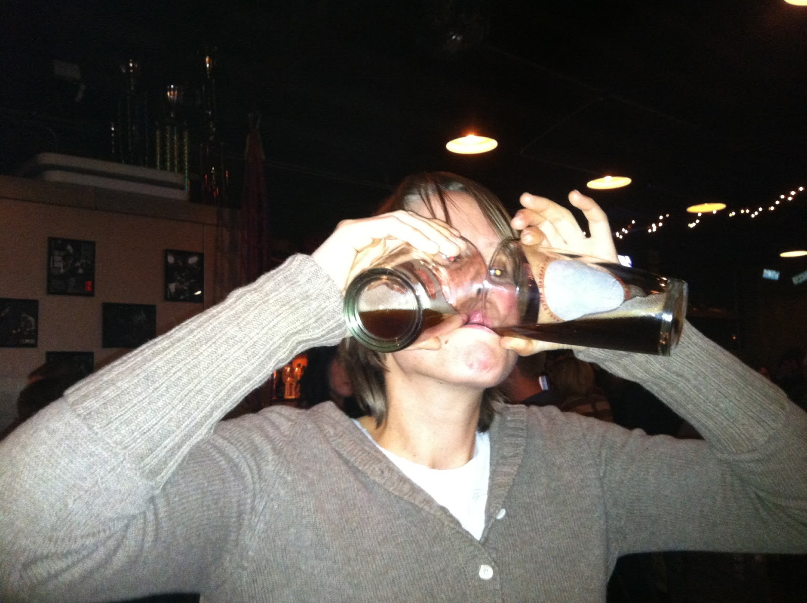
We both ate a little lunch and then began the grueling ascent back up to the Rim. I believe Indian Gardens sits around 4,000 feet and the top of the South Rim is around 7,500. It was a pretty nice climb, but Cough Drop and I nailed it. We made it back to the top in pretty good time. I was actually surprised to have gone down, around, and up the canyon in less than six hours. What to do with our afternoon now? Well first things first, a celebratory drink! I had a specialty spiked coffee to warm-up and Cough Drop had a Grand Canyon IPA.

We chose to spend the last afternoon/evening we had at the Grand Canyon exploring the Kolb Brothers photography exhibit and having a laid back dinner with Li. He made us some really delicious stuffed peppers and we talked about the long-distance hiking community well into the night. And by that I mean, hiker midnight. We were all pretty much in bed by 9:30! I wish I had a little more time in the Grand Canyon, but alas, more places to see on this great trip west.


Thursday, January 24, 2013

Rainbow Bridge National Monument

Cough Drop and I drove from Bandelier National Monument towards the big city of Page, AZ. We really didn't need to go all the way to Page since Rainbow Bridge was en route, but we did need to make our upcoming hike official. We needed to pay for a permit to hike on Navajo land. I had called ahead (I'm a planner!) and knew the permit office would be open that day. We arrived in early afternoon and paid for our permit. The folks at the permit office looked at us like we were crazy hiking in the canyon in winter, but they gave us the permit no less, and a map as well. The map ended up coming in very handy in our hike. We just had a trail description from the NPS website. 


Next up, finding a campsite for the night and some dinner. There was a campground in the town of Page, but we wanted something a little more rugged and pretty. The Wahweap campground and marina was not all that rugged, but it was down by Lake Powell and very pretty. Once again, we were the only campers in the whole place. The campground registration folks said we were crazy when we told him about our Rainbow Bridge plans, but we were getting used to that talk at this point. We set-up camp and set off to find a place to hike and see the sunset. The weather couldn't have been better. 

Being the nerd I am, I made Cough Drop stop at the Glen Canyon Visitor Center so I could read the display cases and learn a little more about the making of the dam. Finally, we pulled over to a trailhead right next to the dam to do some hiking. We were able to climb/scramble all the way down to the water on Lake Powell. It was chilly, but not as chilly as the Smokies mountain stream I had put my feet in just last week. We had a great time playing around there until it started getting cold and dark. It was time for some grub. We ended up at the Dam Bar & Grill for some beers and food. Soon after, we made our way back to the campground and caught some shut eye. 

We both are still on east coast time, so wake up time has been around 4:30 - 5:00 am. We both laid around until about 5:30 am, then jumped out of the tent into the 13 degree morning. It was another day of taking down the camp quick and jumping into Buddy (my truck). After a quick stop of Starbucks, we were on our way to the trailhead. This proved easier said than done. We drove two and a half hours towards the trailhead and never did officially find it. We were on Navajo land, and there really aren't landmarks or trailheads. We ended up parking next to a horse corral and walking in the general direction of the trail (thank goodness for the map we were given!). We walked about a mile and a half and eventually found the trailhead. And by trailhead, I mean a set of rock cairns we think is the trailhead! 

I was a bit nervous hiking into the canyon with very limited markings, but it proved well worth it. From the beginning of the hike, the scenery was spectacular. This hike is called the Rainbow Bridge north route, but it really should be called a canyon route. Most of the hike was climbing in and out of a variety of different canyons. The rocks would be red at one minute and then white a few hours later. My friend Li told me it is actually the same rock, just a very different color.  Blew my mind a little bit. The first mind-blowing area we came to was Bald Rock Canyon. Check out the video to get the full effect. We ended up dropping a thousand feet in about 3/4 of a mile. 

The rest of the day was a maze of different canyons and great views. After about 14 miles of scrambling and hiking, we were both ready to call it a day. We found this amazing campsite under the ledge of a canyon overhang. We couldn't have picked a better spot if we tried. We were protected from the elements and the fire we built kept us warm well into the night. 

We woke up early and anxious with anticipation to see Rainbow Bridge. We left our camp set-up and headed out just with day packs to see the bridge. We made really good time, passing Echo Camp (and of course shouting and waiting to hear the echo!) and finally reaching the bridge. I must tell you that most sane people take the ferry 2 hours from Wahweap Campground (where we also started yesterday morning) and then hike in 1.2 miles to the bridge. But we are a different breed. We hiked 17.5 miles into see this canyon and it was worth it. We had the whole wilderness to ourselves for 48 hours. Rainbow Bridge is the longest natural arch in the states and it was worth the walk. 

Cough Drop and I retraced our steps back to our camp and picked up the rest of our gear. Then, we began the long trek back toward my truck. It was the same route we took the day before, but it was so pretty we both didn't mind taking our time. After 18 miles of hiking, we decided it was time to call it a day. We chose a campsite up on the ridge, with excellent sunset potential. Another chilly night below freezing and we were both looking forward to the predicted warmer temperatures. We had less than an hour hike back to my truck. We were both excited that the truck was still there and even more excited it started after all the cold weather. The best part of the day was seeing the sunrise over Navajo mountain and the canyons below. Can't beat it.

Bandelier National Monument

I started my road trip out west to my new job in California officially on January 8 after my last day in the office in Atlanta. I went to Memphis for a few days to visit with my best friend Lisbeth and her girlfriend Micaela. We had a great time, but it rained the entire time, so no exciting hikes to write about! I feel like the road trip actually started when I picked up my good hiking friend Cough Drop in Albuquerque, New Mexico. Sure, I had drive most of the way across country to get there, but the real fun started when he got there. I will just show one picture of the New Mexico sunset the night I picked up Cough Drop because it was just so pretty.


After a very brief stay in Albquerque (and a very long drive out west), I was itching to get out and do some hiking and camping. I had heard from some friends that Bandelier National Monument was not to be missed. We stocked up on food and headed to the hills. Bandelier is this huge canyon area where the Pueblo people lived 11,000 years ago. There were petroglyphs, dwellings carved into the rocks, and old masonry walls protected by the National Park Service. Since we didn't get there until late afternoon, we opted for a short history loop walk that went by some of the main artifacts and historical elements of the park. It was fantastic. Check out my facebook page for more pictures, but here are a few to give you a taste of what we saw.


The hike we did was in the canyon, but the view from the top of the canyon looking towards the Jemez mountains was equally spectacular. We opted to spend the night here, as it was getting late and it was really pretty. We didn't have to worry about fighting for campsite space, there was only one campground loop open and we were only ones crazy enough to camp that night. The campground sits at about 8,000 feet above sea level and there was plenty of snow on the ground. We set-up our camp on the snow and decided to hike around a bit to watch the sunset and to warm up a bit before cooking dinner.

After a nice sunset, we built a big fire and had some beers to assist in the warming process. The stars were amazing and the company just right. We cooked our respective dinners and soon retired to the tent because it was getting so cold. My watch thermometer read 8 degrees at one point, so it was in fact, chilly. We both woke up super early and decided to just take down camp quick and start driving towards our next stop. But, I did manage to heat water for some oatmeal and hot tea before starting up my sluggish truck for the long drive toward Glen Canyon National Recreation Area. I'll have to come back some other time and do some other trails in Bandelier when I have a bit more time. A must see.

Cold Mountain Backpack

To start the year off right, I decided a backpack trip was in order. I hadn't been feeling well over New Years, so I was unable to do my annual New Years Eve backpack trip. Destination: Pisgah National Forest. I have been wanting to explore Pisgah for several years now. It is so close to Athens, yet I have only done one hike in Pisgah. Hopefully, that will soon change. I emailed a trail friend I have known for awhile and set-up a tentative plan. We both wanted to hike in Pisgah, but were unsure where. I decided to drive up to Asheville Friday night so that we could head out first thing Saturday morning. We ended up having some delicious beers and food from a new place in West Asheville called W.A.L.K. and then hitting another place for some after dinner beer. Dinosuar took one for the team and helped Michie finish off her beer that wasn't too tasty.

After spending some time organizing gear and deciding on our location, we were off to Cold Mountain! The nice thing about Asheville is that you can be at a wide variety of sweet trailheads within an hour. We parked at the Daniel Boone boy scout camp and began the hike up towards Cold Mountain on the Art Loeb Trail. And it was up. We climbed a few thousand feet and about 3.8 miles to the junction with the Cold Mountain Trail. No need to carry our packs the rest of the way, so we stashed those in the trees and started out for the summit. After 1000 vertical feet and 1.5 miles, we made it to the top! The view was amazing and so was the weather. We tried to pick out our next destination of Shining Rock, but couldn't quite see the so-called "shiny rock."

The view was spectacular, but we still some more hiking to do. We made it back down to where we stashed our packs and devoured some lunch. Then onward to Shining Rock. Dinosaur had been there before, so she knew where to turn off the Art Loeb Trail to get to the summit. The rocks are this really cool white color, with gray specks. Apparently, when the sun shines on them, they shine. Hence, Shining Rock. It was starting to cloud over, so no "shining" for us to see, but it was still a lot of fun playing on the rocks.


It was starting to get late in the day, so we made a quick water stop to fill our bottles and then finished the hike to Ivestor Gap. The Art Loeb Trail reminded me of the Grayson Highlands. Big balds with great views. We arrived at Ivestor Gap right before it got dark and quickly set-up camp in the rising wind. Finally got the tent set-up with assistance from some large rocks. The ground was super hard and not stake-friendly. Had a burrito dinner topped off with some Makers Mark and hit the hay.

The wind and rain had moved in over night, so we were a bit damp and tired. But it was not raining, so we quickly too down camp, ate some breakfast, and headed off down the trail. We took a different trail back towards Shining Rock Gap so we wouldn't have to retrace our steps. Then took the Little East Fork Trail back down to Daniel Boone Scout Camp. So glad we did. We followed the creek almost all the way down and it was beautiful. Thought briefly about going for a swim, then had to remind myself that it was still January even though the temperature had risen above 60 degrees. I settled for putting my feet in briefly before finishing out the hike.

I can't wait to do some more exploring in Pisgah next fall. I might just have to finish out the entire Art Loeb Trail. We all know I love a challenge!